Are star maps accurate?
Short answer: yes, when they are calculated properly. Here is exactly how a StarFramer star map is made, and what it does and does not show.
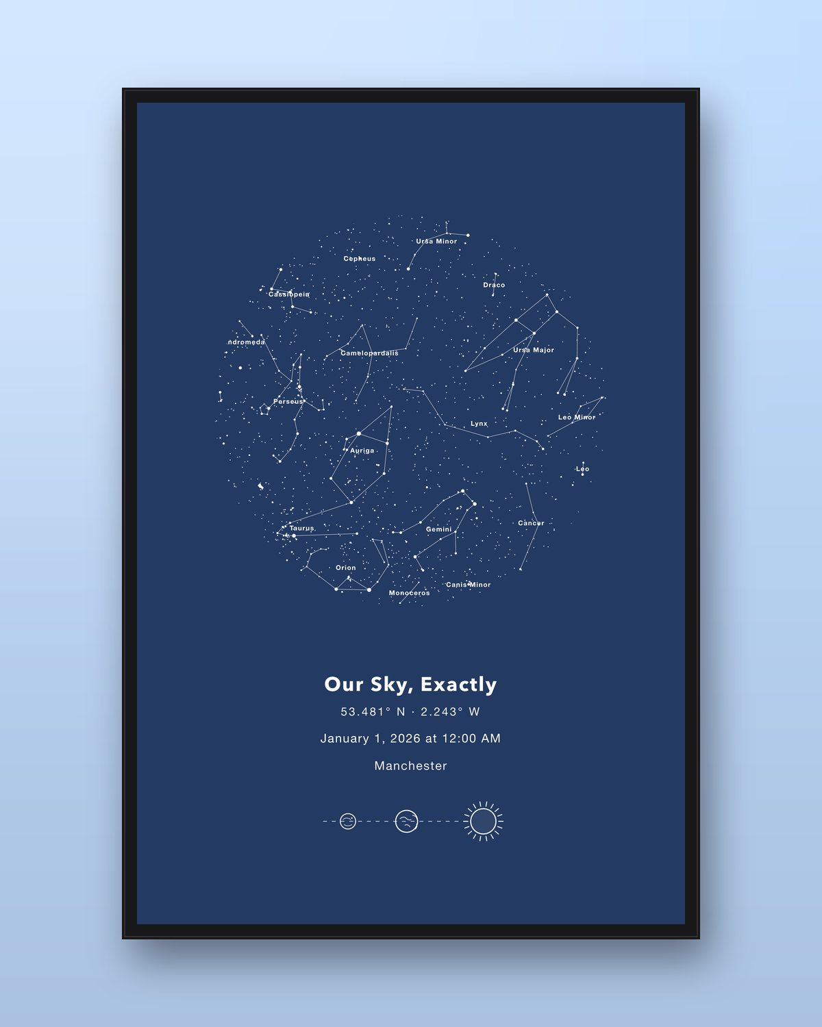
How the map is calculated
- Your place. We turn the location you search for into latitude and longitude. Latitude decides which stars ever rise above your horizon.
- Your moment. We combine the date and local time into the exact orientation of the sky at that moment (its sidereal time). The sky turns about 15 degrees an hour, so time matters.
- Real stars. We plot stars from an astronomical star catalogue at their true positions and brightness: around 7,900 stars down to magnitude 6.4, roughly everything the naked eye can see on a dark night.
- Constellations. Lines are drawn for all 88 constellations, with optional names.
What a star map does not show
- Clouds, weather, or light pollution: the map shows a perfectly clear, dark sky.
- Faint deep-sky objects that need a telescope.
Tips for the most meaningful map
- Use the exact time if you know it, such as the time of a birth or a proposal.
- If you do not know the time, pick an evening time when the stars would have been out.
- Search for the specific town or venue, not just the country.
FAQ
- Are custom star maps accurate?
- A good star map is. StarFramer calculates the position of every star from a real astronomical star catalogue for the exact latitude, longitude, date and time you enter, so the map shows the sky that was actually overhead at that moment.
- How many stars are on a StarFramer star map?
- By default the map plots around 7,900 stars down to magnitude 6.4, which is roughly every star visible to the naked eye under a dark sky, plus constellation lines for all 88 constellations.
- Does the time of day change the star map?
- Yes. The sky turns about 15 degrees every hour, so the same date at 9pm and 3am gives a noticeably different map. Use the exact time if you know it; otherwise pick an evening time when the stars would have been out.
- Does the location change the star map?
- Yes. Your latitude decides which stars are visible at all, and your longitude shifts when they pass overhead. A night in London and the same night in Sydney show very different skies.
- Can I make a star map for a date in the past or future?
- Yes. You can pick any date and time, from a wedding decades ago to a due date that has not happened yet, and the map is calculated for that moment.
- Will clouds or city lights show on the map?
- No. The map shows the stars that were above the horizon at that moment, as if the sky were perfectly clear and dark. It does not show weather or light pollution.